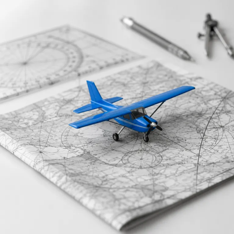
From airport gate to open sky: how pilots know where to go
When you board an aircraft, the cockpit already holds a detailed flight plan. Long before any flight leaves the gate, the pilot and co pilot review a route that has been filed with air traffic control and checked against current weather conditions. That document tells them how they will fly from one runway to another, which navigation systems they will use at each stage, and how much time each segment should take.
Commercial pilots navigate within a structured global network of air routes, which function like invisible highways in the air. These routes connect radio beacons, satellite waypoints, and defined intersections that help every aircraft position itself precisely while flying between cities on different continents. The navigation system in the cockpit cross checks this planned route with real time gps data, radio signals from the ground, and inputs from multiple onboard systems to keep the aircraft on track.
During every phase of flight, from taxi to climb and cruise, pilots fly under strict flight rules that define how they must navigate and communicate. Under instrument flight rules, which govern most airline flights, pilots will follow clearances issued by air traffic controllers who manage traffic control sectors and sequence aircraft safely. Under visual flight rules, often used by student pilots in flight school, the pilot relies more on outside references while still respecting controlled airspace, runway procedures, and local traffic patterns.
The layered navigation systems that guide modern flights
Modern aviation navigation relies on several overlapping navigation systems, so no single failure leaves pilots lost. At the core sits the flight management system, a computer that stores the flight plan, calculates the most efficient route, and constantly updates the estimated time of arrival. This system integrates data from gps satellites, inertial sensors that track aircraft position through movement, and radio navigation receivers tuned to ground based radio beacons.
When you wonder how do pilots know where to go over oceans or deserts, the answer lies in this layered architecture. The primary navigation system uses gps to determine aircraft position within a few metres, while backup navigation systems use radio navigation aids such as VOR and DME stations on the ground. Many airline routes today are flown as RNAV procedures, where the aircraft follows a string of named waypoints such as “NAT” tracks across the North Atlantic or fixes like LAM and BPK around London, and onboard computers guide the aircraft from point to point with high precision.
Air traffic control adds another layer of protection by monitoring each flight on radar and through surveillance systems, then issuing heading or altitude changes to maintain safe air traffic separation. In many regions, controllers also see ADS B position reports transmitted directly from aircraft, which improves tracking accuracy and helps them manage dense traffic flows. By the early 2020s, regulators in North America and Europe reported that the vast majority of commercial traffic was ADS B equipped, supporting projects such as NextGen in the United States and SESAR in Europe that use more precise position data to smooth traffic flows and reduce delays.
Old school skills: pilotage and dead reckoning still matter
Even in an age of satellite navigation, every professional pilot trains extensively in traditional methods. Pilotage, the art of navigating by visual landmarks, teaches student pilots to read rivers, roads, coastlines, and city layouts from the air. This visual navigation skill becomes essential when gps or radio navigation systems fail, or when flying low level routes in remote regions with limited ground infrastructure.
Dead reckoning is another foundational technique that answers the question of how do pilots know where to go when electronics go dark. Using a paper chart, a stopwatch, and knowledge of wind and airspeed, pilots navigate by projecting their aircraft position forward in time along a chosen heading, then adjusting for drift. During flight training, instructors deliberately limit gps use so that student pilots learn to fly confidently using only these core navigation tools and basic radio signals.
Regulators and flight schools insist on these skills because they provide a final safety net when modern systems fail. Training syllabi from major aviation authorities still require pilots to demonstrate pilotage, dead reckoning, and radio navigation during check rides, reflecting a philosophy of resilient aviation navigation where pilots fly with layered competence rather than blind trust in any one type navigation technology.
How air traffic control shapes every route you fly
From the moment an aircraft pushes back, air traffic control starts guiding its path. Ground controllers manage the maze of taxiways, assigning a safe route to the departure runway while keeping airport traffic flowing smoothly. Tower controllers then sequence departures and arrivals, clearing each pilot to enter the runway and fly an initial heading that fits the current traffic pattern.
Once airborne, en route controllers take over and manage air traffic across vast regions of airspace, sometimes spanning several countries. They monitor each aircraft position on their screens, compare it with the filed flight plan, and issue instructions to climb, descend, or turn to avoid conflicting traffic or adverse weather conditions. In busy terminal areas, standard instrument departures and standard arrival routes, often called SIDs and STARs, give pilots predefined paths that fit neatly into the wider air traffic control structure and help everyone anticipate where aircraft will turn or descend.
Approach controllers handle the final stages of flight, guiding aircraft toward the correct runway using a combination of radar vectors, radio beacons, and published arrival procedures. Pilots navigate these arrivals by following precise altitude and speed targets that align them with other aircraft in the sequence. For travellers, this choreography explains why your flight sometimes circles or changes direction near the destination, as traffic control balances runway capacity, weather conditions, and the safe spacing of multiple flights.
Inside the cockpit: how pilots manage technology and time
Life in the cockpit revolves around managing time, workload, and complex systems. During cruise, pilots fly by monitoring the flight management system, cross checking gps based navigation with radio navigation sources, and verifying that the aircraft position matches what they expect from charts and instruments. They will regularly compare estimated arrival times, fuel predictions, and weather updates to decide whether to adjust speed or request a more direct route.
When you ask how do pilots know where to go on long haul flights, part of the answer lies in disciplined cross checking. One pilot handles radio calls with air traffic control while the other focuses on navigation systems, ensuring that changes to the flight plan are correctly entered and verified. This division of duties, supported by standard operating procedures, reduces the risk of programming errors in the navigation system and keeps both pilots engaged in active monitoring rather than passive flying.
Technology also helps pilots navigate high workload phases such as departures and approaches, where time pressure and dense traffic coincide. Lateral and vertical guidance from the navigation system, combined with radio beacons and visual runway cues, allows pilots fly precise paths even in poor visibility. Airline procedures often include short briefings where the captain summarises the planned route, expected approach, and backup options, mirroring the layered planning that helps independent travellers combine digital tools with paper copies or written notes when organising complex journeys.
What travellers can learn from aviation navigation for their own trips
The discipline that helps pilots navigate the sky can improve how you plan journeys on the ground. Just as a flight plan defines route, alternates, and estimated time, a thoughtful travel plan outlines key cities, backup options, and realistic transfer times. When weather conditions or local disruptions affect your route, that structure makes it easier to adjust calmly rather than scramble.
Travel apps and tools now mirror many concepts from aviation navigation systems, turning your phone into a personal flight management system for the road. Map applications act like gps for pedestrians and drivers, while rail and airline apps provide real time traffic and delay information that resembles air traffic updates. When one navigation system fails, such as a map app losing signal, you can fall back on downloaded maps, printed directions, or local advice, echoing how pilots navigate using dead reckoning or radio beacons when needed.
For independent travellers, adopting a pilot mindset means checking weather conditions, understanding local traffic control rules, and building redundancy into every critical step. You might save offline copies of tickets, carry a second payment method, or learn basic phrases for asking directions, which function like backup radio signals when digital tools fail. The more you think like a pilot before you fly or board a train, the smoother and safer your overall travel experience will feel.
Key statistics and trends in modern aviation navigation
- Industry and regulator publications describe a steady shift toward gps based navigation as the primary guidance source for commercial flights, reflecting the rapid adoption of satellite technology across global fleets.
- Reports from aviation authorities note that the introduction of gps, RNAV routes, and advanced navigation systems has significantly reduced navigation related errors and improved route accuracy and fuel efficiency for airlines.
- Next generation air traffic systems, often called NextGen in the United States and SESAR in Europe, aim to increase airspace capacity by using more precise aircraft position data, which allows controllers to safely reduce separation distances on busy routes.
- On busy long haul corridors such as the North Atlantic, daily organised track systems use named RNAV waypoints and flexible “NAT” tracks that shift with the jet stream, helping airlines shorten flight times and reduce fuel burn while maintaining strict separation standards.
- Despite the growth of automation, regulators still require pilots and student pilots to demonstrate competence in dead reckoning and radio navigation during flight training, ensuring that traditional skills remain available as a backup when modern systems fail.
- Industry roadmaps highlight a gradual shift toward more autonomous flight management, yet all major aviation authorities maintain that human pilots will remain responsible for final decisions about when and where to fly for the foreseeable future.
FAQ about how pilots know where to go
How do pilots navigate without GPS or modern electronics ?
When gps and advanced navigation systems are unavailable, pilots navigate using pilotage, dead reckoning, and radio navigation. Pilotage relies on visual landmarks such as rivers, roads, and coastlines, while dead reckoning uses heading, airspeed, and time to estimate aircraft position. Radio navigation adds further support by using radio signals from ground based radio beacons to confirm the route.
What is pilotage in aviation, and when is it used ?
Pilotage in aviation means navigating primarily by reference to visible features on the ground that match what appears on an aeronautical chart. Student pilots learn pilotage early in flight school, especially under visual flight rules in good weather conditions. Even airline pilots may use pilotage as a cross check when flying over familiar terrain or when other navigation systems show unexpected behaviour.
How does air traffic control assist pilots during a flight ?
Air traffic control assists pilots by providing routing instructions, altitude assignments, and traffic advisories throughout the flight. Controllers monitor each aircraft position on their displays and coordinate safe separation between flights that share the same airspace or runway. As training material states, “How does Air Traffic Control assist in navigation? Provides routing instructions and monitors air traffic.”
Why do pilots still learn dead reckoning in modern aviation ?
Pilots still learn dead reckoning because it offers a reliable backup when gps, radio navigation, or other electronic systems fail. During flight training, instructors require student pilots to plan routes using headings, wind corrections, and timing so they can navigate even with minimal instruments. This skill reinforces situational awareness and helps pilots understand how small errors in heading or time can shift the aircraft far off the intended route.
What role do weather conditions play in how pilots choose a route ?
Weather conditions strongly influence how pilots and dispatchers choose and adjust a route before and during a flight. Thunderstorms, strong winds, and low visibility can make certain airways or runways temporarily unsuitable, prompting changes to the flight plan or altitude. Air traffic control then coordinates these changes across multiple flights to maintain safe traffic flow while allowing each aircraft to navigate around hazardous areas.