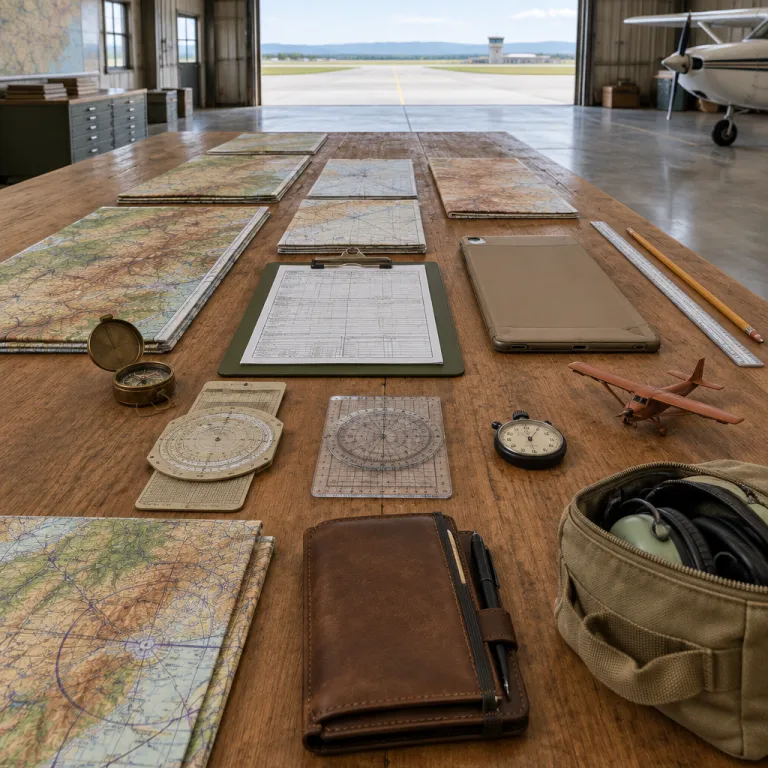
How do pilots know where to go on every flight
When you board an aircraft for a long haul trip, the calm confidence of the pilots can feel almost mysterious. Behind that calm sits a carefully prepared flight plan that tells the crew exactly how they will fly, which route they will follow, and how they will navigate changing weather conditions in the air. Long before you start flying toward your holiday, the pilot and ground dispatch teams have already checked navigation systems, air traffic constraints, and the type of navigation system available along the route.
Professional aviation navigation always starts on the ground with pre flight planning, never in the air at the last minute. The crew and airline dispatchers review the best route for the aircraft, balancing flight time, fuel burn, expected traffic, and forecast weather conditions such as jet streams or storms. They also confirm which navigation systems and radio navigation aids are available along the route, including radio beacons, satellite based GPS, and ground based systems that support safe approaches to each runway.
During this planning phase, pilots navigate complex regulations known as flight rules that separate different types of air traffic. Under instrument flight rules, the pilot will follow a detailed flight plan that has been filed with air traffic control before departure. Under visual flight rules, which are more common for student pilots in flight school or during early flight training, pilots fly using outside visual references but still respect controlled airspace, traffic control instructions, and the limits of their navigation system equipment.
From paper charts to flight management systems in the cockpit
Once you settle into your seat, the cockpit becomes a focused workspace where pilots fly using a blend of traditional skills and advanced systems. Older generations relied almost entirely on paper aeronautical charts and mental dead reckoning, estimating aircraft position from speed, heading, and time flown. Today, those charts still exist, but they are usually displayed on electronic tablets that integrate GPS position, radio signals, and air traffic information into one navigation system.
The heart of modern airline navigation systems is the flight management system, often called the FMS. This computer receives the flight plan from the ground, then uses GPS, radio navigation beacons, and internal sensors to calculate the exact aircraft position at any time. When pilots navigate oceanic or remote routes with few radio beacons, the FMS blends GPS data with inertial navigation systems so that the aircraft can fly accurately even if some radio signals are lost.
Even with this automation, the pilot remains responsible for every decision and cross checks the systems constantly. Airline procedures require that both pilots compare the programmed route in the flight management system with the paper or electronic charts from flight planning. During flight training at flight school, student pilots learn to verify that each waypoint, altitude, and type of navigation aid matches the published route, because a single wrong digit in a coordinate could send an aircraft many kilometres off course. In 2014, for example, an Airbus A320 crew reported to the Federal Aviation Administration that a mistyped waypoint placed their planned track more than 60 nautical miles off the intended airway, a near miss caught only because both pilots carefully compared the FMS route with the official chart before departure.
How radio navigation and GPS guide aircraft through the air
When travellers ask how pilots know where to go, they usually imagine a simple GPS map like on a smartphone. In reality, aviation navigation uses several overlapping navigation systems so that pilots can navigate safely even if one system fails. Traditional radio navigation relies on ground based radio beacons that transmit radio signals in all directions, allowing aircraft instruments to calculate bearing and distance from each station.
Two classic examples of radio navigation aids are VOR beacons and DME distance measuring equipment, which together help pilots navigate airways that criss cross continents. Instruments in the cockpit interpret these radio signals and show the pilot whether the aircraft is left or right of the desired route, and how far it is from the beacon. When several radio beacons are available, pilots navigate by cross checking bearings, which gives a precise aircraft position without using GPS at all.
Satellite based GPS has transformed how pilots fly, but it has not removed the need for radio navigation skills. According to the International Civil Aviation Organization, more than 95 percent of commercial flights now use global navigation satellite systems as a primary positioning source on at least part of the route, yet regulators still require conventional aids as a backup in many regions. Regulators now encourage performance based navigation, including RNP procedures that rely on accurate satellite positioning combined with strict onboard monitoring. These procedures allow aircraft to follow narrow corridors with lateral accuracy as tight as 0.3 nautical miles on some approach paths, which improves access to challenging airports in poor weather. Even so, student pilots still learn dead reckoning and radio navigation during flight training, because resilient aviation navigation depends on layered systems rather than a single technology.
Visual flying, dead reckoning, and the art of pilotage
Not every flight takes place high above the clouds on autopilot, and many travellers experience short scenic flights or seaplane transfers during their journeys. On these flights, pilots fly under visual flight rules and use pilotage, which means navigating by visible landmarks such as rivers, roads, and coastlines. In clear air with good visibility, a skilled pilot can navigate accurately by combining pilotage, dead reckoning, and basic navigation instruments.
Dead reckoning is one of the oldest methods that pilots use to navigate without electronic systems. The pilot calculates the expected aircraft position from the last known fix, using airspeed, heading, and time flown, then adjusts for estimated wind to stay on the planned route. During early flight training, student pilots practise this type of navigation on short cross country flights, learning how small timing errors or uncorrected wind can move the aircraft many kilometres off the intended track.
Even airline captains still rely on visual cues when approaching a busy runway in complex weather conditions. While the navigation system and flight management system guide the aircraft along the published approach, the pilot must judge air traffic spacing, runway alignment, and last minute changes from traffic control. This blend of visual flying, instrument references, and mental dead reckoning ensures that pilots navigate safely even when automation is temporarily reduced or unexpected events occur.
Air traffic control, crowded skies, and keeping your flight on track
Modern travellers often underestimate how crowded the air above major hubs has become, especially during peak holiday seasons. Air traffic control exists to manage this density, ensuring that every aircraft maintains safe separation while still following efficient routes. Controllers on the ground use radar, radio, and advanced systems to monitor each aircraft position, then issue clearances that tell pilots when to climb, descend, or turn.
Communication between pilots and traffic control happens by radio, using standard phraseology that reduces misunderstandings even when accents differ. When air traffic becomes intense near a major runway, controllers may adjust the planned route or holding patterns to sequence arrivals and departures safely. Pilots navigate these changes by updating the flight management system, cross checking the new route against charts, and confirming each instruction back to traffic control in real time.
For travellers planning independent trips, understanding this invisible choreography can change how you think about delays and diversions. A rerouting due to weather conditions or congestion is not a sign that pilots fly without a plan, but proof that aviation navigation is flexible enough to keep safety first. Building realistic schedules that allow time for connections, potential holding, and occasional diversions will make your overall journey feel less stressful and more predictable.
Safety margins, weather, and what happens when systems fail
Every regular traveller eventually experiences a diversion, a go around, or an unexpected delay on the runway. These events usually arise from changing weather conditions, temporary runway closures, or traffic control restrictions rather than technical failures. Behind the scenes, pilots and ground teams constantly evaluate whether the planned route, fuel reserves, and navigation systems still provide comfortable safety margins.
If a navigation system fails in flight, pilots do not suddenly lose their ability to navigate or fly safely. Airline procedures require that crews revert to backup navigation systems, which might include alternative GPS receivers, radio navigation using radio beacons, or even dead reckoning supported by air traffic control radar. During recurrent flight training, pilots practise these scenarios in simulators, learning how to maintain accurate aircraft position awareness while managing time pressure and complex radio communications.
Travellers sometimes worry about medical issues or emergencies during long flights, especially when flying abroad to remote destinations. Airlines coordinate closely with ground based medical support and may divert to the nearest suitable runway if a passenger needs urgent care, which can disrupt your travel plans but protects lives. Understanding how crews balance navigation, fuel, weather, and medical priorities can make those rare diversions feel less mysterious and more like a deliberate safety decision.
Apps, tools, and aviation aware resources for curious travellers
Curious travellers who want to understand how pilots know where to go can now use many aviation aware apps and tools. Flight tracking applications show real time aircraft position, route, altitude, and air traffic around major hubs, giving you a window into the same sky that pilots navigate. Some specialised tools even display which navigation systems or type of navigation aid an aircraft is using near a particular runway, although full professional data remains reserved for certified crews.
If you are considering flight school or simply want to deepen your knowledge, several training platforms simulate basic aviation navigation concepts. These tools let you practise dead reckoning, radio navigation using virtual radio beacons, and GPS based routing, much like student pilots experience during early flight training. By experimenting with different weather conditions, you can see how wind, storms, and air traffic constraints change the optimal route and affect flight time.
Even without becoming a pilot, understanding how pilots fly and how pilots navigate can make you a more informed traveller. You will read your boarding pass, flight number, and estimated time of arrival with a clearer sense of the systems that support each journey. And when you hear the captain mention a change of route, a hold due to traffic control, or a diversion for weather conditions, you will recognise the layers of navigation systems and human expertise that keep global travel both efficient and safe.
Key figures about modern aviation navigation
- Most commercial flights now use satellite based navigation as a primary positioning source, which has significantly reduced reliance on purely ground based radio navigation. ICAO performance based navigation roadmaps indicate that more than 70 percent of instrument approaches at major airports in some regions now include satellite enabled procedures alongside traditional ILS.
- Industry studies show a marked reduction in navigation errors when GPS is integrated with traditional radio beacons and inertial systems, highlighting the safety benefits of layered navigation systems. Eurocontrol analyses of required navigation performance operations report fewer track deviations and more stable approach paths when aircraft use certified RNP procedures.
- Airline operating procedures typically require multiple independent navigation systems on long haul aircraft, so that the loss of one system does not compromise the crew’s ability to maintain accurate aircraft position awareness. A typical wide body airliner may carry dual or triple inertial reference units, multiple GPS receivers, and at least two independent flight management computers.
- Global air traffic has grown steadily over recent decades, which has increased the importance of precise aviation navigation and robust traffic control systems to maintain safe separation between aircraft in crowded airspace. According to the International Civil Aviation Organization and the Federal Aviation Administration, worldwide traffic measured in revenue passenger kilometres has more than doubled since the early 2000s, driving widespread adoption of performance based navigation standards.
FAQ about how pilots navigate the sky
How do pilots navigate without GPS
They use pilotage, dead reckoning, and radio navigation. In practice, this means combining visual references on the ground with time, speed, and heading calculations, then refining the aircraft position using radio beacons and radar support from air traffic control. These traditional methods remain part of standard flight training so that pilots can fly safely even if satellite based systems are unavailable.
What is pilotage in aviation
What is pilotage in aviation? Navigating by visual reference to landmarks. Pilots use rivers, roads, coastlines, and other prominent features to maintain the planned route, especially under visual flight rules in good weather conditions. Student pilots learn pilotage early in flight school, because it builds strong situational awareness that supports later instrument flying.
How does air traffic control assist in navigation
How does Air Traffic Control assist in navigation? Provides routing instructions and monitors airspace. Controllers track each aircraft position on radar or surveillance displays, then issue clearances that tell pilots when to climb, descend, turn, or hold. This partnership between pilots and traffic control ensures that every flight follows safe flight rules while still using efficient routes through busy airspace.
Why do pilots still learn dead reckoning today
Pilots still learn dead reckoning because resilient aviation navigation depends on more than one system. If GPS or certain radio navigation aids fail, the crew can still estimate aircraft position using time, speed, and heading, then refine that estimate with any remaining navigation systems. Regulators and flight schools consider this skill essential for both safety and professional confidence.
What happens if all navigation systems fail during a flight
Total loss of every navigation system is extremely rare on modern aircraft, because regulations require multiple independent systems. If several systems were lost, pilots would revert to basic instruments, visual references when possible, and intensive support from air traffic control radar to maintain safe separation and guide the aircraft toward a suitable runway. In parallel, standard operating procedures would prioritise safety, including potential diversions and generous fuel margins.
Sources: International Civil Aviation Organization, Federal Aviation Administration, Eurocontrol.